Walking, Transit or a Mix: Choosing How to Cross a City
Choose how to cross a city by weighing distance, travel time, and what you want to notice, then combine walking and transit without overplanning.
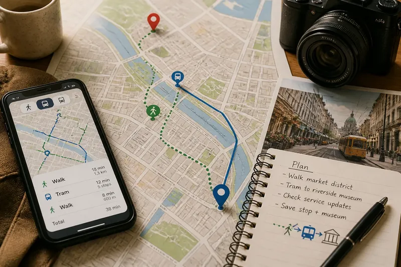
You step out of a station into a city you have never seen, with a museum across town and a bakery glowing on the next corner. Choosing how to cross a city is not just a distance problem: walking, public transit, or a mix can shape what you notice and how much of the day the journey takes.
What do you want the journey to do?
Start with the experience you want between one place and the next. If the route itself appeals—shopfronts, street art, a river path—walking turns travel time into sightseeing. If you would rather arrive with your attention fresh, transit can carry you past ordinary blocks while you rest or watch the city change through the window.
Separate the day’s must-reach places from the things you would enjoy discovering along the way. A timed ticket or an evening reservation makes arrival time more important; an open stretch of afternoon leaves room for detours. You do not need to assign every block a purpose.
Choose the journey’s priority before opening a map. “See the old town on foot” and “reach the gallery without a long walk” lead to different routes, even if the endpoints are identical.
How far is comfortable on foot?
Look at the route, not only the distance shown on a map. A short straight line may cross a highway, climb steep streets, or offer little shade; a longer riverside path may feel easier and more rewarding. Check the route’s surface and crossings, too, especially if you use a mobility aid, travel with children, or have luggage.
Consider what you will carry and how you feel right now, not just what you expect to feel later. Heat, rain, slippery paving, and a crowded sidewalk can turn a pleasant stroll into a chore. A walk that looks manageable on a screen may be less appealing after a full day of standing.
Say you are near a central market and want to reach a neighborhood bookshop. Imagine the direct route follows a noisy avenue, while a parallel street passes a small square; choosing the quieter walk could make the trip more enjoyable, even if it takes a little longer. If rain begins or your energy dips, a nearby transit stop can become the sensible alternative.
When does public transit make more sense?
Transit is useful when it cuts out a dull or tiring stretch, connects distant neighborhoods, or helps you arrive at a specific time. Check the route map for the right direction and transfer points, then look at service notices before setting off. A direct bus may be easier than a train that requires a confusing station change.
Allow for the whole trip, not just the ride. Walking to a stop, waiting, transferring, and finding the exit all take attention. In an unfamiliar station, a little extra time can make the trip calmer; follow the signs and check the stop name before you board.
Think about what transit offers you besides speed. A bus can reveal the changing character of several neighborhoods; a subway can make a long cross-city journey straightforward but hide the streets above. If seeing the city is part of the point, save a walk for the most interesting stretch.
How can you compare the route options?
Compare realistic versions of the trip in a map app or transit app. Check walking directions, transit departures, service alerts, and the location of entrances rather than assuming the nearest station entrance is on your side of the street. Then make a choice based on the day you actually have.
- Distance: Is the walking route comfortable for your pace and footwear?
- Time: Does transit still help after waiting, transfers, and station access?
- Terrain: Are there hills, stairs, busy crossings, or a smoother alternate street?
- Interest: Which stretch would you most like to experience on foot?
- Flexibility: Can you change modes if weather, energy, or service changes?
For fares, accessibility, and operating rules, check the transit agency’s current information and any relevant local guidance. The right option can depend on the city and the particular route.
What questions help you choose?
Is walking or transit faster across a city?
It depends on the route, time of day, service, and how far you are from a stop or station. Compare the full door-to-door journey rather than the ride time alone.
When should I combine walking and public transit?
Combine them when transit handles a long or uninteresting stretch and walking covers a compact, appealing area. It also works well when you want to save your energy for a neighborhood you are keen to explore.
How do I choose a route if I want to see the city?
Walk the parts with inviting streets, public spaces, or a view you care about, and use transit between them. A map can suggest a route, but street-level details help you decide where a walk will feel worthwhile.
Should I buy a transit pass for one day?
Compare the pass terms with the trips you expect to take and the fare options offered locally. If you are unsure how much you will ride, check whether the agency explains single fares, day passes, and payment methods before committing.
How do you make a mixed route easy to change?
Pick one walking section and one transit connection rather than plotting every turn of the day. Save the destination and nearest useful stop in your phone, and keep an offline map available if you may lose service. This gives you a route to follow without locking you into it.
Imagine you plan to walk through a lively market district, then take a tram toward a riverside museum. If the market holds your interest, you can linger; if the streets are crowded, you can head for the tram sooner. Either way, the journey still has a clear next step.
Before leaving, check the latest service notice and the weather, then decide which part you most want to walk. For choosing how to cross a city, that small decision is often enough: let transit bridge the distance and save your feet for the streets you came to see.